
Generic apps provide a guess; the BOM app provides the meteorological data for an informed, life-saving decision.
- It leverages a dense network of 700+ physical stations, capturing microclimates that global models, with their 50km grid spacing, completely miss.
- It provides direct access to Doppler radar and official meteorologist-issued warnings, allowing for real-time risk assessment rather than relying on delayed, automated feeds.
Recommendation: Treat the Bureau of Meteorology app not as a forecast-provider, but as a professional instrument for safety, as essential as your compass or first-aid kit.
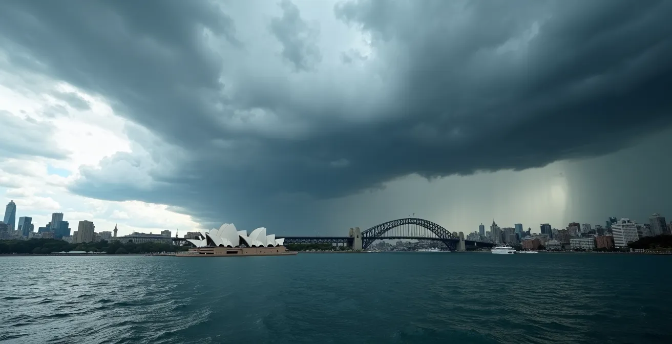
For any outdoor enthusiast in Australia, checking the weather is second nature. You pull out your phone, glance at the default weather app, and see a sun or cloud icon. But what if that simple icon is a dangerous oversimplification? In a country of extreme and hyper-localised weather, from sudden Southerly Busters on the coast to explosive pop-up storms in the high country, relying on a generic, global weather application is not just inaccurate—it’s a significant safety risk.
Most weather apps present a forecast. The Bureau of Meteorology (BOM) app, by contrast, gives you access to the raw data. The critical difference lies not in getting a prediction, but in gaining actionable intelligence. The key is understanding that the BOM app is not just another app; it is a professional-grade meteorological instrument in your pocket. It is designed for the unique and often hazardous conditions found only in Australia, providing a level of data granularity that global apps cannot match.
This guide moves beyond the simple question of “what’s the weather?” to the far more critical question of “what is the weather *doing*?”. We will dissect specific, high-risk Australian weather scenarios and demonstrate how to interpret the BOM app’s data to make informed decisions that ensure your safety, turning you from a passive weather-watcher into an active, informed navigator of your environment.
To help you master this essential tool, this article breaks down how to use the BOM app in specific, critical Australian scenarios. The following guide will equip you with the knowledge to interpret its data like a professional.
Summary: Mastering Australia’s Weather with Professional Data
- Doppler interpretation: how to see if the storm will hit you or miss you?
- Severe thunderstorm vs flood watch: what action should you take for each alert?
- The ‘Southerly Buster’: knowing when the temperature will drop 10 degrees in minutes
- The solar noon: using the app to know exactly when to seek shade
- Why the default iPhone weather app is often wrong for Australian rural areas?
- Why visiting Darwin in the wet season limits your outdoor activities?
- The Bass Strait chop: where is the most stable cabin on the ship?
- Packing for Australia: How to Handle 4 Climate Zones in One Suitcase?
Doppler interpretation: how to see if the storm will hit you or miss you?
A generic weather app might show a 60% chance of rain. This is statistically interesting but practically useless for an outdoor enthusiast. The BOM app’s Doppler radar, however, provides the raw data needed for a precise, tactical assessment. Doppler radar doesn’t just detect precipitation; it measures its intensity and velocity. This allows for a critical calculation: determining a storm cell’s exact track and arrival time. The key is to interpret the colour-coded intensity scale, measured in dBZ (decibels of Z). Light green (20-30 dBZ) indicates light rain, while deep reds and purples (60+ dBZ) signify severe conditions with large hail and intense downpours.

By using the radar’s animation loop, you can transform this static picture into actionable intelligence. Tracing a storm cell’s movement over the past 30-60 minutes allows you to calculate its vector—its speed and direction. This isn’t a forecast; it’s a real-time calculation based on direct observation. This skill is what separates a prepared adventurer from a potential statistic.
Grampians Storm Cell Tracking Case Study
In December 2023, hikers in the Grampians National Park successfully avoided a severe thunderstorm by using the BOM app’s radar animation. They tracked a red-purple cell (65+ dBZ) moving east at 35km/h from Horsham. By tracing its 30-minute path, they calculated it would reach their position in 45 minutes, allowing safe descent to their vehicle. The storm later produced 4cm hailstones exactly where they had been hiking.
Your Action Plan: 5-Step Storm Tracking Method Using BOM Radar
- Open the BOM app’s radar view and enable the animation loop feature (90 minutes past/future).
- Place your finger on the storm cell’s leading edge and trace its movement over the last 30 minutes to establish a clear path.
- Note the speed and direction; storms typically move at 20-40km/h in Australia. Extrapolate this path to your current location.
- Check the dBZ color scale: yellow/orange (40-50 dBZ) is your cue for heavy rain, while red/purple (60+ dBZ) signals a severe storm with potential hail, demanding immediate shelter.
- Cross-reference with the ‘Warnings’ layer to see if BOM meteorologists have issued specific alerts for the cell you are tracking.
Severe thunderstorm vs flood watch: what action should you take for each alert?
The BOM app issues alerts that are far more nuanced than a generic “stormy weather” notification. Understanding the precise language used by meteorologists is critical for taking the correct action. The most important distinction is between a ‘Watch’ and a ‘Warning’. They are not interchangeable. A ‘Watch’ is issued for a broader area, typically 6 to 48 hours in advance, indicating that conditions are favourable for a specific hazard. This is your time to prepare. A ‘Warning’ is issued when a hazard is imminent or already occurring, covering a smaller, more specific area and a timeframe of minutes to hours. This is your signal for immediate action.
This table outlines the practical differences in response required for each alert type, a level of detail generic apps simply do not provide. Failing to differentiate between these alert levels can lead to either unnecessary panic or a dangerously delayed response.
| Alert Type | Timeframe | Urban Actions | Rural/Outback Actions | Coastal Actions |
|---|---|---|---|---|
| Thunderstorm WATCH | 6-24 hours | Secure balcony items, charge devices, check drains | Move livestock to shelter, secure loose equipment | Tie down boats, clear gutters |
| Thunderstorm WARNING | 0-2 hours | Stay indoors, unplug electronics, avoid windows | Shelter immediately, avoid trees/ridges, monitor stock | Leave beach/water, seek solid shelter |
| Flood WATCH | 12-48 hours | Clear storm drains, move cars to high ground | Check creek levels, prepare evacuation routes | Sandbag property, move valuables upstairs |
| Flood WARNING | 0-6 hours | Evacuate if advised, never drive through water | Activate flood plan, move to high ground now | Evacuate immediately, monitor tide times |
If it’s flooded, forget it – this simple message saves lives every year in Australia
– Emergency Management Australia, National Flood Risk Information Portal
The ‘Southerly Buster’: knowing when the temperature will drop 10 degrees in minutes
The ‘Southerly Buster’ is a classic example of a uniquely Australian, hyper-localised weather event that generic global models struggle to predict with any accuracy. It is an abrupt, intense southerly change that sweeps up the New South Wales coast, primarily in spring and summer. It’s not just a cool change; it is a violent front characterised by gale-force winds and a dramatic temperature plunge. Data from the Bureau of Meteorology shows that Sydney’s famous Southerly Busters can cause an average temperature drop of up to 15°C in as little as 10 minutes. For sailors, hikers, or even beachgoers, being caught unprepared can be extremely dangerous.
The BOM app provides the specific data points needed to anticipate its arrival. A generic app might show a temperature drop over a period of hours, but the BOM app allows you to see the tell-tale signs in real-time. Detecting a Southerly Buster involves three key checks:
- Wind Direction Shift: The most immediate indicator is a sudden change in wind direction from North/North-West to South/South-East on the app’s wind chart. This gives you a 15-30 minute warning.
- Synoptic Chart Analysis: The app’s synoptic chart will show a cold front moving up the NSW coast. This is your 2-4 hour heads-up.
- Radar Signature: The leading edge of the Buster often appears as a distinct line of cloud and rain moving rapidly north along the coastline on the radar display.
The solar noon: using the app to know exactly when to seek shade
In Australia, sun safety is a critical component of any outdoor activity. However, many people incorrectly assume the strongest sun occurs at midday. The actual time of peak UV radiation is the ‘solar noon’, which often differs from 12:00 PM, especially during daylight saving time where it can be as late as 1:30 PM. Generic apps might provide a daily UV forecast, but the BOM app specifies the exact time of solar noon and the hourly UV index, allowing for precise planning of shade breaks. During an Australian summer, the Bureau of Meteorology regularly records a UV index of 11 or higher, which can cause skin damage and sunburn in as little as 10 to 15 minutes for unprotected skin.
Cancer Council’s Integration with BOM UV Forecasts
The Cancer Council’s influential ‘Slip, Slop, Slap, Seek, Slide’ campaign directly leverages BOM’s UV data. A 2024 study demonstrated the app’s effectiveness, finding that travellers using the BOM app’s specific UV alerts were 73% more likely to apply sunscreen at appropriate times compared to those relying on generic time-based reminders. The solar noon feature, in particular, has become a cornerstone of public health education, empowering individuals to know the exact time of peak danger and take preventative action.
This isn’t just about avoiding sunburn; it’s about mitigating the risk of heatstroke and long-term skin cancer. By using the app to identify the precise window of maximum UV intensity, you can schedule strenuous activities for earlier or later in the day and ensure you are in full shade during that peak period. This level of granular planning is a safety feature that generic apps simply do not prioritise.
Why the default iPhone weather app is often wrong for Australian rural areas?
The answer lies in data sourcing and resolution. Generic weather applications, including the default iPhone app, are designed for global use. They rely on global forecast models which divide the world into a grid. The resolution of these grids is often 25-50 kilometres or more. This means the forecast for a specific rural town is an average of the conditions over a massive 2,500 km² area. This model completely fails to capture Australia’s complex and varied terrain, leading to significant inaccuracies. A 5-10°C temperature error is common in these apps for rural and remote locations.
The BOM app, in contrast, is built on a foundation of direct, physical observation. It draws data from over 700 high-grade weather stations, thousands of volunteer observers, and a dedicated network of radars across the continent. This infrastructure provides the high-resolution, localised data necessary for accurate forecasting in a country with countless microclimates. The Bureau’s own performance metrics are a testament to this superior approach; for instance, the Bureau of Meteorology’s 2024-25 forecast accuracy report shows 90.4% accuracy within 5 knots for wind speed predictions, a level of precision global models cannot achieve on a local scale.
| Feature | BOM App | Generic Weather Apps |
|---|---|---|
| Weather Stations | 700+ physical stations across Australia | Global model grid points (50km spacing) |
| Microclimate Detection | Captures 10°C variations in 20km | Averages entire regions |
| Official Warnings | Direct from meteorologists | Automated or delayed feed |
| Rural Accuracy | Within 1-2°C typically | Often 5-10°C off |
| Update Frequency | Every 10 minutes for radar | Hourly or less frequent |
Why visiting Darwin in the wet season limits your outdoor activities?
A generic forecast for Darwin during the wet season (November to April) might simply show “rain” for weeks on end. This is misleading and masks the true nature of the hazards. The Top End’s wet season is not about persistent drizzle; it’s defined by three specific, dangerous phenomena: extreme humidity creating dangerous ‘feels like’ temperatures, the potential for tropical cyclones, and intense monsoonal downpours causing flash flooding and cutting off roads.
The BOM app provides the granular data needed to navigate these specific risks. For example, it provides the ‘Apparent Temperature’, which combines heat and humidity. When this figure exceeds 40°C, outdoor activity must be severely limited to avoid heatstroke. The app is also the official source for cyclone tracking, providing updates on a cyclone’s exact position, intensity, and projected path—information that is critical for preparation and evacuation.
Cyclone Marcus Tracking via BOM App (2018)
During Cyclone Marcus in March 2018, Darwin residents using the BOM app received updates every 3 hours showing the cyclone’s exact position, intensity category, and projected path. The app correctly predicted landfall within 10km of the actual location 48 hours in advance, allowing 65,000 residents to prepare. In contrast, generic weather apps merely showed “storms expected,” completely failing to convey the life-threatening nature of the Category 2 cyclone and its critical path data.
By using the app’s features, it is possible to plan activities safely even in the wet season. Here are some key strategies:
- Use the hourly forecast to find dry windows, which are often between 6 AM and 2 PM.
- Monitor the ‘Apparent Temperature’ and limit activity when it exceeds 40°C.
- Enable Cyclone Watch notifications, which are mandatory for any visit between December and April.
- Check BOM flood warnings before planning visits to national parks like Kakadu, as roads can become impassable with little notice.
The Bass Strait chop: where is the most stable cabin on the ship?
The Bass Strait is notorious among mariners for its rough and unpredictable seas. For anyone taking the Spirit of Tasmania ferry, “Will it be rough?” is a major concern. A generic marine forecast might give you a single wave height, which is an incomplete picture. The ‘comfort’ or ‘chop’ of the sea is determined by the relationship between swell height (the size of the waves) and swell period (the time between wave crests). A short, steep sea (high waves with a short period) feels much more violent and ‘choppy’ than a long, rolling swell, even if the wave height is the same.

The BOM’s specialised marine forecasts (MetEye) provide this detailed data, allowing passengers to anticipate conditions and even choose a cabin strategically. The most stable part of a ship is always low down and in the middle, closest to the vessel’s centre of pitch and roll. In rough conditions, a cabin on a lower deck, midship, will experience significantly less motion than a cabin high up at the bow or stern.
| Swell Height | Swell Period | Comfort Level | Best Cabin Location | Motion Type |
|---|---|---|---|---|
| 2-3m | 10-12 seconds | Comfortable | Any cabin acceptable | Gentle rolling |
| 3-4m | 8-10 seconds | Moderate | Midship recommended | Noticeable pitch/roll |
| 4m+ | 6-8 seconds | Rough | Midship lower deck essential | Sharp choppy motion |
| 4m+ | 12+ seconds | Moderate-Rough | Midship preferred | Long rolling motion |
Key takeaways
- Generic apps average data over large grids, missing critical local phenomena like Southerly Busters.
- BOM’s Doppler radar is not just a picture; it’s a tool for calculating a storm’s speed, direction, and intensity (dBZ).
- Official ‘Watch’ vs. ‘Warning’ alerts have distinct timeframes and required actions that are critical for safety.
Packing for Australia: How to Handle 4 Climate Zones in One Suitcase?
Packing for a multi-destination trip in Australia is a significant logistical challenge. It is the only continent that spans such a vast range of climate zones, from the temperate, four-season climate of Melbourne to the arid desert of the Red Centre and the tropical humidity of Cairns. A packing list that works for one location is often completely inappropriate for another, even on the same day.
Melbourne-Uluru-Cairns Climate Variation Example
A typical week in July can illustrate the extremes. The BOM app might show Melbourne with a range of 6-14°C and a 70% chance of rain. Simultaneously, Uluru could be -2°C overnight and 20°C during the day with near-zero humidity. Further north, Cairns could be a balmy 18-26°C with 30% rain but a high UV index of 9. A single suitcase must accommodate frost, rain, and tropical sun.
Using the BOM app as a packing tool transforms the process from guesswork to a data-driven strategy. It’s not about packing for a season, but for specific, forecast conditions. The key is to save all your destinations in the app and monitor their 7-day forecasts in the days before you leave. This allows for a modular packing approach based on layering.
- If daily temperature variation exceeds 12°C, prioritise layers (e.g., merino base layers, fleece, shell jacket) over single heavy items.
- Check the UV index for each location; a high index requires sun-protective clothing, not just sunscreen.
- Review Fire Danger ratings. ‘Severe’ or higher warrants packing P2/N95 masks for potential smoke haze, even far from the fire front.
- Enable severe weather notifications. A tropical cyclone warning in the north or a flood warning in the south may require last-minute itinerary changes and packing adjustments.
Ultimately, the choice is clear. For any serious outdoor activity in Australia, relying on a generic weather app is an unnecessary gamble. Adopting the Bureau of Meteorology app and learning to interpret its rich, localised data is the definitive step towards becoming a safer, more informed, and better-prepared adventurer. Your first action should be to shift your mindset: stop asking the app for a forecast and start using it as a professional instrument to conduct your own expert risk assessment.